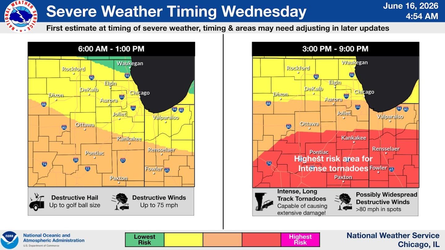
The National Weather Service is warning of a potentially dangerous severe weather outbreak across northern Illinois on Wednesday, June 17.
Forecasters said the atmosphere may support supercells capable of producing strong tornadoes, damaging winds exceeding 80 mph, large hail, and torrential rainfall. Storm Prediction Center issued a Day 2 Moderate Risk (Level 4 of 5) for areas south of Interstate 80.
Cook and Lake counties fall within the broader threat zone. The highest tornado risk remains near and south of I-80, but forecasters cautioned the exact location could shift depending on how morning storms evolve.
NWS Chicago said on X that a powerful storm system will bring multiple rounds of thunderstorms Wednesday, "including the threat for a dangerous outbreak of damaging tornadoes and severe thunderstorms across the general region."
An initial round of strong to severe thunderstorms could move into northern Illinois on Wednesday morning, according to Shaw Local's report on the NWS forecast, published Tuesday, June 16. Additional storms may redevelop during the afternoon and evening as a warm front lifts northward.
Storms could produce more than 2 inches of rain per hour, raising flash flooding concerns. The NWS also warned of dangerous conditions at Lake Michigan beaches Wednesday and Thursday, relevant to North Shore lakefront communities.
The warning arrives during an unusually active stretch. Illinois leads the nation in tornado activity in 2026 with 133 reported twisters as of June 12, according to NOAA's Storm Prediction Center.
A June 11 outbreak produced 29 confirmed tornadoes and a derecho across Illinois and northwest Indiana.
The NWS urged residents to review severe weather safety plans and ensure they have multiple ways to receive warnings. Updated forecasts are available at weather.gov.